Flakes, Flights, and Forecasts
Snowpack Measurement Enhancements in the Uinta Mountain Headwaters
Background
Water users in Utah—one of the driest states in the nation—and fellow Colorado River Basin states face future water supply gaps due to increasing demand and uncertain future hydrologic conditions. As pressure builds on Utah and the Basin’s limited water supply, employing the best available science, tools, and data will become increasingly important to support drought mitigation and resilience.
Snowpack contributes 95% of Utah’s water supply, making accurate measurement of snowpack necessary for both short-term system operations and long-term planning. Snowpack data collected by Airborne Snow Observatories, Inc. (ASO) is currently the most spatially robust snow data available. The ASO Inc. suite generates spatially complete maps of snow depth, snow water equivalent, and snow albedo through remotely sensed data, and snowpack and runoff modeling frameworks to provide the best possible water resources data. ASO Inc. is the sole licensee from NASA/JPL/Caltech to commercialize snow surveys with this software suite. ASO products have been tested and operationalized in other Western states but have not yet been tested in Utah.
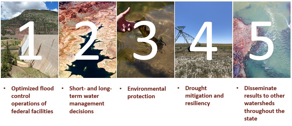
Project Objectives
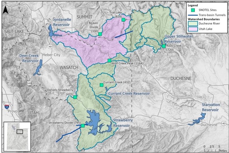
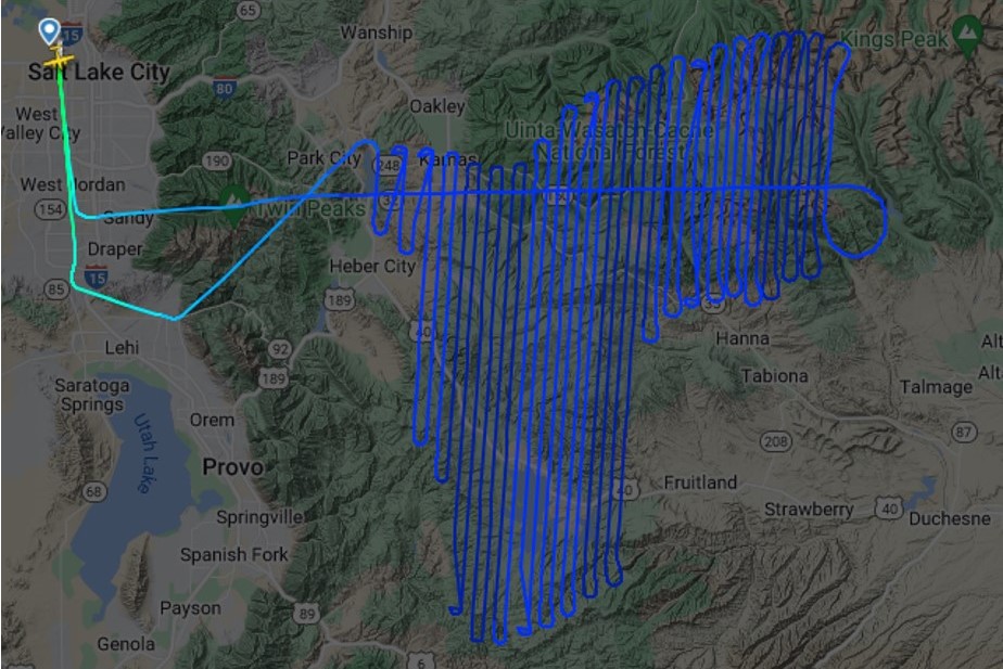
Project Location Flight Path
Funding

Reports